The Paintbrush Divide – Lake Solitude Loop
Posted by Jim Steele on August 26th, 2008 filed in Grand Teton National ParkThe Lake Solitude / Paintbrush Divide loop is one of the most dynamic all-around hikes in the Tetons, offering two gorgeous alpine lakes, fantastic views from 10,700 feet above sea level, and a good chance to see wildlife. This kind of hike is just what the Tetons are all about! You’ll hike up Paintbrush Canyon, past Holly Lake, and cross Paintbrush Divide. From there, you descend to Lake Solitude and follow Cascade Canyon back to Jenny Lake. You’ll see some of the most beautiful terrain in the park.
Of course, the loop is almost 20 miles and you gain about 4,000 feet of elevation, so you’ll feel some pain once you get home. This trip can be done as a day hike, but you’ll also run into a bunch of people that make it an overnighter. There are plenty of campsites along this trip – Paintbrush Canyon has backcountry camping zones above and below Holly Lake, and there is another below Lake Solitude in the North Fork of Cascade Canyon.
View Larger Map
Along the way, you’ll walk right by two gorgeous alpine lakes: Holly Lake and Lake Solitude. You’ll also hike along Jenny Lake and near the shores of String Lake. From a distance, you’ll see Leigh Lake and Jackson Lake as you climb Paintbrush Canyon. On the divide, you’ll look down on Grizzly Bear Lake, Mica Lake and Mink Lake, as well as Lake Solitude. And the views of the mountains from the divide are fantastic, particularly of Mt. Moran, Mt. Woodring and the less-traveled terrain of the northern Teton range.
Paintbrush Divide melts relatively late in the season, so unless you’re armed with an ice axe, you’ll probably have to wait until August. There are some steep, barren slopes between Holly Lake and the divide. The rest of this adventure opens up earlier – it is possible to get to Lake Solitude in June, for example.
You have a bunch of options on this hike. You can start from the south Jenny Lake area and hike along Jenny Lake back to the Cascade Canyon trailhead to begin your loop (about 24 miles, round trip), you can ride the Jenny Lake Boating shuttle across Jenny Lake to the Cascade Canyon trailhead (about 20 miles roundtrip) or you can start at the String Lake parking area (again, about 20 miles).
And you can hike the loop clockwise or counterclockwise. Both options have their advantages. Walking up Cascade Canyon to Lake Solitude allows you to gain much of the elevation on this hike relatively gradually before you make the 1,700-foot climb from Lake Solitude to Paintbrush Divide. However, hiking up Paintbrush Divide and then coming down through Cascade Canyon gives you head-on fantastic views of the Grand Teton between Lake Solitude and the Cascade Canyon forks. This option requires you to gain most of the 4,000 feet of elevation within about seven miles between String Lake and the Divide, so it is challenging. This article will describe the trail starting at the west Jenny Lake boat dock, hiking along the shore of Jenny Lake to String Lake, then climbing up Paintbrush Canyon to Paintbrush Divide and descending to Lake Solitude and returning via Cascade Canyon.
You can either hike two miles of Jenny Lake shoreline from the South Jenny Lake area to the west boat dock, or ride the shuttle. If you’re planning to do this hike in one day, I’d recommend taking the shuttle. Jenny Lake Boating operates a 7 a.m. shuttle for much of the summer, and you’ll want that head start. Call (307) 734-9227 for the current schedule and be sure to find out when the last boat of the day is.
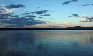
From the west boat dock, you’ll follow the trail along the Jenny Lake shoreline for about a mile and a half north toward String Lake. The view of Jenny Lake from this section of trail is gorgeous, and you can also look back and get a few good perspectives on the Cathedral Group of the Tetons. You’ll also enjoy the sight of Sleeping Indian rising far off in the distance above the lake. This can be a busy section of trail and if you get an early start, you’ll be glad that you missed the crowds.
Just before the String Lake parking area, you’ll come to a signed junction with a trail to your left. Turn left here; you’re 1.3 miles from the Paintbrush Canyon trail. This trail will lead you just above the west shore of String Lake, which is another beautiful setting. Part of this trail is out in the open, which gives you a great perspective on String Lake. After you have pulled away from String Lake, rising above a serene meadow, you’ll come to a “Y” junction with the Paintbrush Canyon trail, which will be on your left. The trail to the right leads to the outlet between Leigh Lake and String Lake and eventually back to the String Lake parking lot. The trail on the left leads you right into the heart of Paintbrush Canyon.
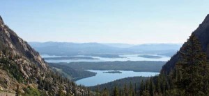
From here, the real work begins. You have about 2,200 feet of elevation to gain over 4.7 miles before you arrive at Holly Lake, and from there, another 1,300 feet over about two miles to Paintbrush Divide. Portions of the trail to Holly Lake are reasonably gradual, but you will encounter some challenging switchbacks as you close in on the lake. You’ll follow a stream for part of the climb and will see a small cascade just north of the trail. You’ll pass in and out of forests, and when you enter a clearing, be sure to enjoy the view of the valley behind you. At some points, Jackson Lake absolutely dominates the horizon. The views from the switchbacks during the final mile to Holly Lake are some of the best.
After you complete the switchbacks, you’ll come to a junction, with one trail leading directly to Paintbrush Divide and the other making a detour to Holly Lake. Unless you’re in such a hurry to get to the divide that you can’t be troubled with a stop at a gem of an alpine lake, you should take the detour to Holly Lake. Both trails are comparable in distance and the Holly Lake trail rejoins the Paintbrush Canyon trail about 0.4 miles above Holly Lake. On the way to Holly Lake you will see another small lake off to your left; continue on the main trail for a few more minutes. At 9,410 feet, Holly Lake is tucked right against Mt. Woodring and makes a fantastic place to have a snack before you continue to climb up Paintbrush. In addition, there are campsites near the lake. It is possible to scramble up Mt. Woodring without technical gear, although I’ve never done it.
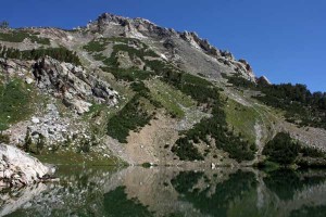
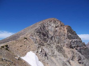
From Holly Lake, you are about two miles from Paintbrush Divide. The terrain is largely sub-alpine as you leave Holly Lake, but as you near the divide, you’ll enter barren, rocky slopes. Unless you are hiking very late in the season, you will probably cross a few snow fields – I’ve done this hike in late August twice and encountered snow each time. These are steep slopes with some possible sudden falls below, so if you’re doing this hike early in the season, an ice axe would be a necessity.
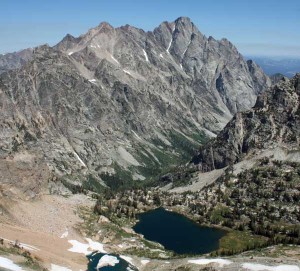
The elevation at Paintbrush Divide is 10,700 feet – nearly 4,000 feet higher than Jenny Lake. Your perch on Paintbrush offers one of the coolest views in the park. The view down Paintbrush Canyon, with the walls of the canyon framing the valley below, is awesome. So is the sight of Mt. Woodring and Mt. Moran. To the south, you can see the Grand Teton and Table Rock. West of the divide, you’ll see Lake Solitude and the turquoise-green Mica Lake, tucked into the walls of Cascade Canyon above Lake Solitude. Just below you, you see Grizzly Bear Lake. And to the north, you’ll see some of the less-explored backcountry of Grand Teton National Park. Fewer trails run through the canyons around Mt. Moran, so this might be your best chance to see some of this terrain. If you’re craving that “top-of-the-world” feeling, there aren’t a lot of places better than Paintbrush Divide. Ironically, you won’t see Jackson Lake from the divide. It dominated the view looking toward the valley as you climbed up the canyon, but from the top, Mt. Woodring and Mt. Moran block the view of the lake.
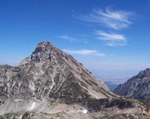
You have one more option to make a great view even better. Just north of the Paintbrush Divide trail, you see a small peak. It’s a short 10-15 minute scramble to the top, and although it looks like an impossible climb as you’re ascending Paintbrush Divide, once you get to the divide, you’ll see that it is actually a manageable scramble. You’ll gain about 200 more feet of elevation, but the view from the top of this peak is so much better than the view from the main trail that it’s worth it. The 200 feet make a major difference in how far you can see – from the top, you can also see the silhouette of mountains in southern Yellowstone as well as the checkered farmland of Eastern Idaho. With the exception of Mt. Woodring, there probably isn’t a better view of Mt. Moran in the park.
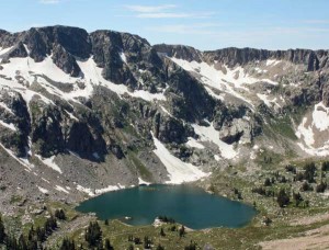
From Paintbrush Divide, you descend down the walls of upper Cascade Canyon to Lake Solitude; it’s about 2.4 miles. Lake Solitude is one of the most pleasant backcountry lakes in Grand Teton National Park. It’s near the end of the North Fork of Cascade Canyon, so you’ll be surrounded on three sides by the walls of the canyon. On the fourth side, just beyond the canyon, the Grand Teton looms. The setting is gorgeous and the canyon is pristine. At 9,035 feet, the snow can last well into the summer here. One year the lake was still largely frozen on the Fourth of July. Even in late August, the waters are still too chilly for anything but a very short dip.
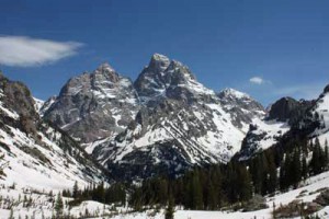
From Lake Solitude, you hike 2.7 miles down the North Fork of Cascade Canyon to the Cascade Canyon forks. You’ll continue losing elevation, passing through a camping zone and hopping Cascade Creek a couple of times via bridges. Enjoy the sight of the Tetons rising directly in front of you on this stretch of the trail – and don’t forget your camera. This is one of the better views of the Grand Teton that I’ve seen, and there are some places where you have a nearly unobstructed view. If you’re a shutterbug, the creek, trees and wildflowers present some unique compositional opportunities.
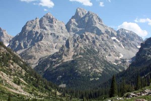
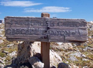
At the Cascade Canyon forks, a junction leads you either east to Jenny Lake or south to Hurricane Pass. You’re 4.5 miles from the west Jenny Lake boat dock and this will be the final leg of your journey. The famous Teton Crest trail passes through here. Adventurers looking for a backpacking trip often start hiking near Jackson Hole Mountain Resort and go above Death Canyon, through Alaska Basin, over Hurricane Pass, down to the Cascade Canyon forks, then hike up to Lake Solitude and over Paintbrush Divide before finishing their trip at String Lake. This multi-day trip covers roughly 35 miles, depending on where you start and where you finish.
You’ll enjoy the hike down Cascade Canyon, although by this point in the adventure you are probably feeling some serious aches and pains. The walls of the canyon climb steeply above you to the north and south. Early in the season, waterfalls are abundant. Throughout the season, you might see climbers on these walls. You’ll follow Cascade Creek most of the way. Near the forks, watch for moose grazing in or near the meandering waters. As you near the end of Cascade Canyon, you’ll come to a junction with the horse bypass trail. From this junction, it is 0.9 miles back to the west Jenny Lake boat dock if you take the horse bypass trail, or 1.2 miles if you go via Inspiration Point. The horse bypass trail is less crowded and quicker, but you miss the chance to see Hidden Falls. It’s interesting to contrast the peaceful waters of Cascade Creek in the canyon with the tumbling waters of Hidden Falls.

This is one of my favorite Teton loops. It’s a tough hike to do in a day, but if you’re in shape and don’t mind feeling sore for a day or two, it can be done. You pass a bunch of camping areas, so you could make a great overnighter too. Between the alpine lakes, the outstanding views, the possibility of seeing wildlife and – if you time it right — the huckleberries along the shores of Jenny Lake and String Lake and in lower Paintbrush Canyon, this is one of the most dynamic hikes in the Tetons, giving you a taste of just about everything the park has to offer. As a bonus, the wildflowers last well into the summer.


September 4th, 2008 at 7:35 am
Sounds fantastic. I’m drooling.
November 8th, 2009 at 9:57 pm
[…] I’ve written a full description of the Paintbrush Divide – Lake Solitude loop here. […]