Shoshone Geyser Basin and Shoshone Lake
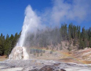
Posted by Jim Steele on October 19th, 2008 filed in Yellowstone National ParkOne of the more intriguing – and less discovered – hikes in Yellowstone National Park is the trek to Shoshone Geyser Basin. This hike offers three unique things to see, and each of them is worth the trip. First you’ll see Lone Star Geyser, which erupts about 40 feet out of a 10 foot-tall cone. Then you’ll come to the edge of the Shoshone Geyser Basin, an unspoiled backcountry treat with dozens of densely packed thermal features. And nearby is Shoshone Lake, the largest backcountry lake in Yellowstone.
If you come in via Lone Star Geyser, this hike will be roughly 17 miles and will take up most of your day. Additional side trips are possible once you get to Shoshone Lake. This hike is difficult only due to its length – the highest climb is a modest 450 feet over Grants Pass. There are several other options to get to the geyser basin. You could go in via the DeLacy Creek Trail or the Lewis Channel or Dogshead trails near Lewis Lake.
Due to the comparatively low elevation, this hike makes a great fall adventure. The highest point is about 8,050 feet, at Grants Pass. I’ve hiked this trail in the middle of October and the first weekend of November. Both times I encountered several inches of snow for few miles on Grants Pass, but the destination made the wet shoes worthwhile. The leg of the trail to Lone Star Geyser is even more accessible. I haven’t hiked this earlier in the season, but suspect that mosquitoes are a major nuisance for the first half of the summer.
View Larger Map
To get there, look for the Lone Star trailhead just southeast of the Old Faithful area on the Grand Loop Road. From the Old Faithful interchange, it’s 2.5 miles. Watch for the Kepler Cascades parking area; the Lone Star parking area is just beyond the Kepler Cascades lot. Alternatively, the trailhead is 15.1 miles west from West Thumb junction.
I won’t write about the hike to Lone Star Geyser in any great detail here, as I described it earlier this summer. From the parking lot, you’re about 2.5 completely flat miles from Lone Star. You’ll follow the Firehole River along a partially paved trail nearly the whole way. Mountain bikes are permitted on this segment, so you could make this a combined biking / hiking adventure. The trail is closed to bikes past Lone Star, however. This is also a popular cross-country ski route.
Once you get to Lone Star, check the log to see if you can figure out how long it will be until Lone Star’s next eruption. If you’re lucky, you’ll time it so that you can see an eruption along the way. Lone Star erupts every three hours and it’s a great show to see – especially since you’re close to the geyser and most likely will only be watching with a dozen or so other people.
So far, you’ve come about 2.5 miles. Continue for just a few minutes to the signed junction with the Howard Eaton Trail. If you head north on this trail, it drops into the Old Faithful area after about three miles. Head south; you’re about 5.8 miles from the edge of Shoshone Geyser Basin. At this point, you join with the Continental Divide Trail.
The area just after the junction is interesting in its own right. You’ll see a few minor thermal features – hot pools, vents, etc., off to the side of the trail. They aren’t nearly as dynamic as the ones you’ll see at Shoshone, but they do add an element of intrigue to this section of the trail. You’ll cross a sturdy footbridge over the Firehole River, which will go on to flow down the Kepler Cascades and through the Upper Geyser Basin at Old Faithful. There are also three backcountry campsites in this area.
Next, you’ll skirt the edge of a few meadows where you just might see the buffalo roaming and where you can’t help but expect to see an early trapper emerge from a cabin. After these meadows, you start the climb up Grants Pass. Between Lone Star Geyser and the top of the pass, you’ll gain about 450 feet to 8,050 feet above sea level. You’re in trees virtually the whole way, so you won’t get to soak in what would otherwise be decent views. Although the area between the junction with the Howard Eaton Trail and Shoshone Geyser Basin is pleasant, you’re probably going to want to hike quickly because there’s nothing exceptionally noteworthy here and that will give you more time to explore the lake and geyser basin. Note that when you cross Grants Pass, you are also crossing the Continental Divide.
From the top of Grants Pass, you will descend to a signed junction with the Bechler River Trail, which would eventually take you to the Three Rivers Junction (10 miles) and beyond to the Cave Falls area. From this junction, you’re one mile from the Shoshone Geyser Basin Horse Bypass Trail and two miles from the edge of the geyser basin.
Over the next mile, you’ll hop a small creek that flows into Shoshone Creek, then hop Shoshone Creek itself. For most of the rest of the hike, you’ll follow Shoshone Creek through a small winding “canyon-let”, staying to the north of the creek. After a mile, you come to the junction with the horse bypass trail, which again hops Shoshone Creek. Note that horses are not allowed in the geyser basin. Stay on the main trail; you’re about a mile away. Along this section of the trail, you might also notice that the soil has a much grittier, volcanic flavor – in some places, plants don’t even grow.
A mile beyond the junction with the horse bypass trail, you come to a junction with the North Shoshone Lake Trail. This trail loosely follows the north shore of Shoshone Lake and intersects with the DeLacy Creek Trail. If you have the option of doing a shuttle, you could leave a second car at the DeLacy Creek trailhead; from here, it’s 10.7 miles. Otherwise, follow the signs to the edge of the geyser basin and Shoshone Lake. You’re just a few minutes away.
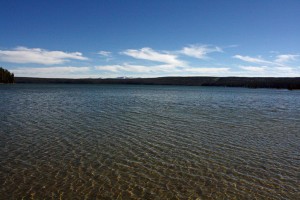
At the next junction, you can head south to explore the geyser basin or continue for a couple minutes to the shore of the lake. Shoshone Lake is gorgeous. It is the largest backcountry lake in Yellowstone – the shortest hike to get there is the 2.9-mile DeLacy Creek Trail. However, you might see kayakers on the lake. People sometimes will put in at Lewis Lake along the South Entrance Road and kayak about 4.5 miles up the Lewis River to Shoshone Lake. Numerous campsites are situated along the shores of Shoshone Lake. Motorized boats are not allowed.
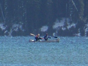
My preference has been to eat lunch along the shores of the lake, then go explore the geyser basin. It’s interesting to note that you’re only seeing part of Shoshone Lake. It has a unique barbell shape, so you never really get the chance to take in the whole thing all at once. It would be fun to stay at one of the numerous campsites around the lake so that you had more time to explore the vast shore.
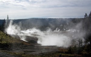
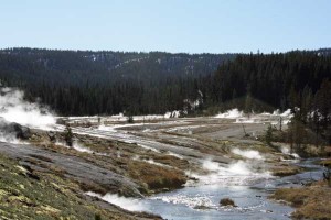
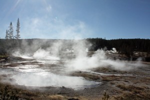
Next, get out and explore the geyser basin! According to the National Park Service, there are 80 geysers in an area of 1,600 by 800 feet. You’ll see hot pools, geysers and mudpots, with Shoshone Creek running through the middle. The geyser basin is largely pristine. There are no boardwalks, which is a blessing and a curse. You’ll be able to explore more than you would around a developed thermal area, but remember to be careful – a man died here in 1988.
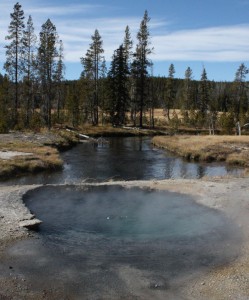
As you start hiking into the basin from the north, you’ll be able to see the steam from dozens of steaming thermal features. It’s a beautiful place – you’re deep in the forest, you’re viewing a large thermal area, and most likely, there aren’t many people around. Enjoy the range of colors, the beautiful geyser basin surrounded by mountains, and the view of dozens of stacks of steam rising into the air.
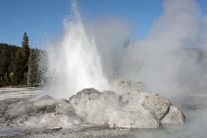
About halfway through the basin, you’ll see Minute Man Geyser, a spouter just off the trail that erupts every minute or two. You can take some great pictures here. You also will see Taurus Geyser, with a dark blue color and an orange rim that looks like a hot pool but has been known to erupt. At the south end of the basin, you’ll see Union Geyser, with three side-by-side cones. Union is currently dormant. Near Union there is a hot pool set several feet below the ground. It has a deep blue color. Just be careful – anything that falls into this pool is not coming out.
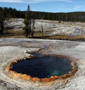
If your muscles are aching, look for a swimming hole in Shoshone Creek where the hot runoff from the thermal area mixes with the river water. It’s illegal to get into the thermal areas, but you can swim around in the creek.
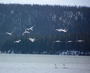
And of course, you have a decent chance to see all kinds of wildlife along this hike, especially as you get closer to Shoshone Lake. Watch for bears, elk and birds.
To get home, retrace your steps.
This is one of my favorite hikes in Yellowstone. I love the experience of exploring a geyser basin without boardwalks and without crowds of tourists – especially in this beautiful of a setting. Seeing Lone Star along the way and Shoshone Lake are bonuses. I’m not sure why more people don’t get back here – even the summer that I lived in Yellowstone and did dozens of hikes, we didn’t hike to Shoshone. I’m sure the distance is a major factor, but if you get a good start, it’s a very reasonable day hike – and would be an even better overnight excursion.

October 29th, 2012 at 10:12 pm
[…] have two choices: You can start retracing your steps – go back to the Shoshone Geyser Basin, Mt. Holmes and the Bechler Canyon. Or you can start visiting some of the second-tier locations, […]