Phelps Lake
Posted by Jim Steele on June 18th, 2009 filed in Grand Teton National ParkPhelps Lake is a gorgeous lake – the sixth largest in Grand Teton National Park – and is set right at the base of the Teton Range, left behind by the glacier that formed Death Canyon. It offers lots of options for someone who is looking to get outside – and the choices got even better in late 2007 with the opening of the Laurance S. Rockefeller Preserve.

           Mr. Rockefeller, through his famous family, owned the JY Ranch, which was set at the south end of Phelps Lake and included much of the shoreline. The heart of the ranch was donated to Grand Teton National Park in 2001. In 2007, the Laurance S. Rockefeller Preserve opened with an extensive trail system in place, finally giving everyone access to the entirety of Phelps Lake.
           As part of the terms of the donation, Mr. Rockefeller wanted the former JY Ranch to be a place where people could develop a deeper connection with the land. The new trail system was developed with that goal in mind – there are places to walk right up to a small waterfall, walk through a wetland, and sit on benches on a bridge over Lake Creek, Phelps’ outlet. Pamphlets note that the primary trail starts in the sagebrush zone, passes through forests, and then comes to the lake, with some wetland trails also available. If you’ve got guests in town that want to get a sense of what the Tetons are all about, without, for example, hiking up the Middle Teton, this would be an excellent place to start.
           Mr. Rockefeller’s gift was exceptionally generous – I’ve hiked around Phelps Lake many times and enjoyed every trip. At the same time that I note his contribution, I also want to thank John D. Rockefeller Jr., who was responsible for the formation of Grand Teton National Park. The entire park could be called the John D. Rockefeller Jr. Preserve.
View Larger Map
(Note: The Google map above does not show the LSR trails.)
           Phelps Lake sits at 6,633 feet above sea level, so the elevation gain to the lake is modest. There are two main access points: first, via the LSR Preserve trailhead, which is north of Teton Village. Drive up Highway 390 through Teton Village, pass the Granite Canyon Entrance Station, and pass the Granite Canyon Trailhead; the LSR Preserve will be on your right and is well marked. Park in the modest parking lot and follow the short trail to the visitor center. You can also drive south from Moose along the Moose-Wilson Road.
           Second, there is a trailhead at the end of the Whitegrass Ranch Road. This road junctions with the Moose-Wilson Road three miles south of Moose. Drive down the road (only a portion is paved) for just over 1.5 miles to the parking lot at the Death Canyon Trailhead. Note that this road is badly rutted. It is possible, but definitely not ideal, to get over it in a non-high-clearance car. There are some small parking lots along the way, so you can stop and walk the rest of the way if the road gets too treacherous.
           The trail system is well marked and there are numerous options, so I’m not going to give step-by-step directions here. But I will offer lots of ideas for how to enjoy this area of the park.
           Hike the Lake Creek – Woodland Trail Loop: This excursion starts at the LSR Preserve visitor center, combining the Lake Creek Trail and the Woodland Trail in a 2.9-mile loop. You’ll follow Lake Creek part of the way, meandering through the forest, crossing the Moose-Wilson Road, passing some enormous glacial boulders, and coming to the south shore of Phelps Lake. You can do the loop in either direction. Elevation gain is limited to a few hundred feet, so this is an ideal family outing. If you do this trail, take the time to read the pamphlet available at the trailhead – it gives you a much greater appreciation of the various environments you’re walking through.
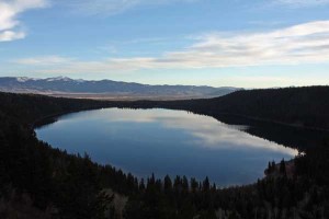
           Walk to the Phelps Lake Overlook and the lake via the Valley Trail: This route was accessible even prior to the establishment of the LSR Preserve. Start at the Death Canyon Trailhead at the end of the Whitegrass Ranch Road. After a tenth of a mile, you intersect with the Valley Trail. Turn left and continue on to the Phelps Lake Overlook. You actually start at an elevation higher than Phelps then climb about 400 feet to the overlook above the north end of the lake. This gives you a really cool view of Phelps, the valley beyond, and the Gros Ventres. The hike to the overlook is just short of a mile. From the overlook, you can descend another mile to the lake.

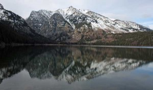
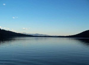
           Walk the Phelps Lake loop: Access Phelps via either the Valley Trail or the Preserve trails, and then loop around the lake. The trail itself is roughly four miles, which does not include the distance to get to the lake. The views around Phelps Lake are incredible. From the south shore, you see the lake set against the Tetons. From the north shore, you see the lake set against the Gros Ventres. Be sure to take the short spur trail to Huckleberry Point, which juts into the lake from the southwest shore and gives you a great perspective on the lake and the Tetons. Speaking of huckleberries …
           Go huckleberry hunting: Phelps Lake grows a bumper crop of huckleberries, so watch for a tasty snack, particularly along the south shore and near Huckleberry Point later in the summer. Be sure you know what you’re looking for. And bear in mind that bears like huckleberries too.
           Cross country ski or snowshoe: Phelps Lake is also a favorite cross-country skiing or snowshoeing destination. The Moose-Wilson Road is closed in winter from the Granite Canyon trailhead to the junction with the Whitegrass Ranch Road, so you’ll have a longer journey than in the summertime. But the sight of the lake set against the Tetons makes it worth the trip. I like to park at the Granite Canyon trailhead, ski up the Moose-Wilson Road for about a mile to the old JY Ranch Road, and then follow the old JY Ranch Road for less than a mile to the south shore of Phelps Lake.
           Hike into Death Canyon: If you want a longer adventure, the possibilities are endless. Through Death Canyon, you can eventually access the Teton Crest Trail or can take the challenging – but very rewarding – hike up Static Peak. Even just hiking into the narrow, long, unforgettable Death Canyon is worth your time. Hiking up Open Canyon or doing the Open Canyon – Granite Canyon loop are also possibilities. Note that all of these are full-day – at least – adventures.

           Other options: There are a few backcountry campsites located near the north end of Phelps Lake. … Go fishing … Or hike the Boulder Ridge Trail and Aspen Ridge Trail in the LSR Preserve.
           Phelps Lake’s low elevation makes it accessible for much of the year. I’ve hiked to the lake as early as May and as late as mid-November. Its proximity to Jackson makes it a great choice for an after-work hike. And the area offers numerous trails, giving you plenty of options. Don’t forget your camera – this is one of the most photogenic lakes around.
          Â
Links: Grand Teton National Park lakeshore hikes brochure (PDF)
