Crystal Butte
Posted by Jim Steele on July 22nd, 2013 filed in Around TownOne of the best things in the world is a great after-work hike. The criteria? You don’t have to drive far to get to the trailhead, you get a serious workout, you’re rewarded with an awesome view … and you can start after 5 p.m. and be done by dusk. Somehow, it gives you the energy to return to the salt mines the next day.
In Jackson, Crystal Butte fits that description perfectly. In 1.7 miles, you’ll gain 1,500 feet, be treated to a view of the Tetons and the town of Jackson, and give your lung capacity a rigorous test.
Crystal Butte looms directly east of Jackson, northeast of Snow King Mountain and just north of Cache Creek. A trail switchbacks up the steepest sections before petering out, and interconnections are available with trails in the Cache Creek area. Much of the butte lies in the Gros Ventre Wilderness, so wilderness regulations apply.
To find the trailhead, look for a short dirt road behind some houses on the east side of Nelson Drive near East Hansen Avenue. After a short drive, you’ll arrive at a small parking area. The trailhead is marked with a large sign on the south side.
After .3 miles, you’ll come to a marked junction. This trail leads up Crystal Butte, but the sign notes that the Crystal Butte trail has been rerouted, presumably to keep the entire butte from eroding into Cache Creek. Obey the sign and follow the main trail for another two-tenths of a mile. You’ll quickly arrive at a marked junction with the new trail up Crystal Butte. Turn left here; this is where your workout really begins.
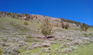
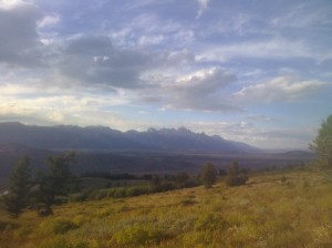
You’ll follow a long series of switchbacks as you climb up the unforested face of Crystal Butte. Be forewarned – the next 0.8 miles are steep. When you hike back down, you’ll want to make sure that you aren’t carrying a phone or iPod because there is a very real possibility that you’ll slip and fall on your butt. But as you climb, you’ll be treated to views of Jackson, Rendezvous Mountain, Cache Creek, the entire Teton Range and much of Jackson Hole. At .9 miles from the trailhead, you’ll see wilderness boundary signs. Then you’ll cross a small gulch where wildflowers may be seen into July. After 1.3 miles, the grade moderates, then at 1.6 miles, you’ll arrive at a point directly above Woods Canyon with perfect views up Cache Creek. The trail jogs to the north, and within a tenth of a mile, you’ll be treated to views of the Tetons towering over Jackson Hole. (Note that for the best views, you’ll have to step below the trail.)
Most likely, you won’t want to go any farther, even though you’re not at the top of Crystal Butte. The trail continues for a few more minutes, but gradually peters out after entering a forest before getting to the actual summit. Bring a snack and enjoy the view of the Tetons (and, if your timing is good, the wildflowers) from the hillside. When you’re done, retrace your steps back to the trailhead.
Notes: Don’t be surprised if you encounter a few mosquitoes, particularly early in the season. … During the first half mile, you’ll be on trails that are popular with cyclists, so be alert. … Although the exposed face means that snow burns off much of Crystal Butte early in the season, be aware that spring closures are usually in effect in April to protect wildlife. … It is possible to hike up Woods Canyon and hike down Crystal Butte (or vice versa), but the trails do not connect, so you’ll have to blaze your own route. Don’t do this if you’re not familiar with the area and aren’t confident in your route-finding ability.


